
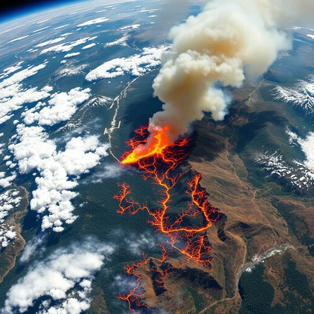
Wildfires have emerged as one of the most urgent environmental issues of our era. With increasing global warming, prolonged droughts, and shifting weather patterns, wildfires aren't only becoming more common, but also more destructive. Areas that were previously considered low-risk are now experiencing crippling fire seasons season after season. The Amazon, California, Australia, and Canada have all seen record-breaking wildfires in recent years, causing loss of biodiversity, huge carbon emissions, and displacement of people. Over 4.4 million acres burned in the U.S. in 2023 alone, as reported by the National Interagency Fire Center (NIFC). As the climate crisis worsens, so does the unpredictability and size of these fires, requiring smarter, faster, and more forward-thinking solutions.
For decades, detection of forest fires has depended largely on ground patrols, lookout towers, weather stations, and citizen reports. Although these have been effective, they are, by nature, reactive, detecting fires only after they have begun, sometimes when they are already burning out of control.
It is one of the principal limitations: lack of coverage and swiftness. Monitoring from the ground is slow, cumbersome, and even incapable of reaching extensive or distant forested regions in time. Equally, fire towers can see only a limited distance and are reliant upon human observation, which may result in delayed notification or failure to notice the first early signs.
To counter the growing menace of forest fires, the globe requires solutions beyond conventional, responsive measures. It is here that artificial intelligence (AI) and satellite imagery join hands as a powerful change agent. Using real-time satellite imagery and AI-based analysis, it is now possible to identify potential signs of wildfires early on, forecast high-risk areas, and track extensive forest cover with unparalleled speed and precision.
AI systems can inspect satellite imagery to identify faint signs, such as heat patterns, smoke plumes, and natural trends, that would be hard or time-consuming for people to notice by hand. Such systems can scan thousands of square kilometers within minutes, delivering scalable monitoring even in far-flung or inaccessible locations. Through predictive modeling, officials can implement preventive measures before fires break out at all, saving lives and ecosystems alike. In essence, AI and satellite technology are revolutionizing wildfire management from being a responsive approach to proactive prevention, and in doing so, they present an invaluable aid to combating climate-fueled catastrophes. Satellite imagery is instrumental in shifting the management of wildfires from slow and reactive to quick and data-intensive. New-generation satellites have onboard thermal sensors, multispectral cameras, and high-resolution imaging technologies that can survey extensive forest areas at all times, typically with data taken every few hours. These satellites are capable of sensing heat anomalies, vegetation health changes, dry fuel accumulations, and even initial signs of smoke plumes. Satellites differ from ground systems in that a single pass can observe millions of hectares of land, including distant or inaccessible parts where conventional surveillance is not feasible. There are two broad categories of satellite data in wildfire management:
Passive imagery (e.g., optical and infrared) that records natural light and heat to sense temperature increases and dryness of vegetation.
Active sensors (e.g., radar or LiDAR) that can penetrate clouds or smoke, allowing fire detection even in low visibility.
Tools such as NASA's FIRMS (Fire Information for Resource Management System) offer near-real-time satellite imagery to emergency responders globally. By monitoring in real time and updating, satellites offer a vital early warning system, allowing authorities to identify possible fire outbreaks before they spread.
Artificial Intelligence (AI) is the eye behind the brain of satellite systems, which enables more intelligent, quicker, and more precise forest fire prevention. Satellite imagery yields enormous quantities of visual information, but AI algorithms process the data in real-time to identify patterns, forecast fire danger, and aid in decision-making. Employing methods such as machine learning, deep learning, and computer vision, AI can: Detect early fire signals from heat emissions, smoke anomalies, or changes in vegetation using satellite imagery. Forecast high-risk areas by using past fire histories, weather conditions, wind currents, and moisture levels of the vegetation. Watch for long-term environmental trends and identify subtle indications that might otherwise go unnoticed by humans. For instance, deep learning models such as Convolutional Neural Networks (CNNs) can be trained to identify wildfire-specific features from multispectral images with high accuracy. These computer vision systems can identify thousands of images in minutes, providing near-instant notifications to the firefighting team and the forest department. Additionally, AI-based systems such as WIFIRE (created by UC San Diego) and instruments employed by NASA or ESA facilitate the simulation of fire activity, enabling the authorities to anticipate and deploy resources in advance and initiate firebreaks before catastrophe occurs.
The convergence of AI and satellite imagery is no longer on paper—it's already making a big difference in forest fire prevention and management worldwide. Governments, research organizations, and technology firms are rolling out cutting-edge solutions that blend real-time information with smart algorithms to get ahead of wildfires.
WIFIRE is an innovative platform that employs AI to simulate fire behavior from satellite imagery, weather, and terrain. It assists emergency responders in predicting how a fire will propagate and where to deploy resources. During California's wildfire seasons, WIFIRE has played a key role in cutting response times by as much as 80%.
FIRMS provides live thermal imaging from NASA's MODIS and VIIRS satellites, detecting hotspots globally. The information is publicly available and is utilised by scientists, governments, and conservation bodies to track and act upon fire incidents in real-time.
They run high-resolution imagery satellites in private companies and offer AI-based analytics for environmental observation. Their imagery assists in monitoring vegetation health, fuel accumulation, and assessing damage after a fire. AI models analyze this imagery to determine areas prone to fire and enhance forest management techniques.
Australia, the most wildfire-affected country, uses satellite data integrated with AI tools to identify fire risks and dryness of vegetation. Satellite-based tools assisted in near real-time mapping of damage during the 2019–2020 Black Summer fires, facilitating recovery efforts.
ESA's Sentinel-2 satellites provide free, high-resolution imagery of the Earth. Combined with machine learning, these data enable European nations to track fire activity, evaluate forest health, and forecast future fire occurrences with greater accuracy.
Combining AI with satellite imaging has transformed the way we detect, forecast, and combat wildfires. The dynamic duo provides a number of significant benefits over conventional means:
AI software can interpret satellite information in near real-time to identify heat signals, smoke, and other preliminary signs of a fire, enabling authorities to act before blazes get out of control.
Satellites can survey millions of square kilometers all at once, including distant forests, mountains, and national parks that are otherwise difficult to reach with ground patrols or sensors.
With historical fire information, weather trends, and vegetation health, AI can predict where and when fires will most likely happen. Compared to periodic field reports, satellite systems offer permanent data streams, and AI guarantees it's being processed in real-time, permitting real-time decision-making amid crises.
AI models learn to identify subtle signs that may pass unnoticed or incorrectly interpreted by people. This produces more precise detection and fewer incorrect alarms, ensuring better resource use. With intelligent risk maps, firefighting teams can be strategically deployed to the highest risk areas, achieving the greatest effect while minimizing cost and risk.
With the escalating threat of wildfires due to increasing frequency, intensity, and uncertainty, it is apparent that conventional firefighting strategies are no longer sufficient. The combination of AI and satellite imaging provides an effective, scalable, and proactive strategy for forest fire prevention with real-time monitoring, early warning, predictive risk assessment, and intelligent resource allocation.
By integrating enormous satellite data with the pattern recognition and predictive power of artificial intelligence, we're heading toward a future where fires can be detected and contained before they get out of hand. Real-world systems such as NASA's FIRMS, WIFIRE, and ESA's Sentinel programs are already demonstrating the success of this strategy, illustrating that technology can be an effective partner in environmental conservation.
But even as the outcomes are encouraging, there are hurdles to overcome, ranging from data constraints to model precision and availability. Innovation, cooperation, and investment in AI-based fire prevention systems are needed to help our forests—and the life that they sustain—and our future prosper. In an ever-more climate-altered world, adopting such smart, tech-based solutions is not only an option, it's a requirement.
Powered by Froala Editor